
Atuh Beach (Pantai Atuh), Nusa Penida: A Practical Visitor Guide

Atuh Beach needs about half a day, not an afternoon. The white-sand cove sits on Nusa Penida's far southeastern tip, and the ride there plus the stairway down and back up eats more time than the beach itself. This guide covers where the beach is, the scooter route from Toya Pakeh harbor, the ticket booth and reported entry fee, the descent, and the east-side stops worth adding on the same loop.
Where Atuh Beach is
Atuh Beach, or Pantai Atuh, lies in Pejukutan village on the southeastern coast of Nusa Penida, part of Klungkung Regency. The bay is pinched between two high green cliffs, which is why the sand feels enclosed and the approach runs along a clifftop rather than down a beach road. The Bali provincial tourism site describes the cove as white sand and clear blue water framed by those two cliffs, with limestone outcrops just offshore.
Nusa Penida is the large island off Bali's southeastern coast, and Atuh sits across it from the main harbor at Toya Pakeh, so crossing the island is part of the trip. If you are still mapping the island's sights, the full set of Nusa Penida Attractions shows how the east-coast beaches cluster together.
Getting there from Toya Pakeh
Most visitors arrive by fast boat at Toya Pakeh and rent a scooter on the spot. One traveler's guide puts the ride to Atuh at roughly 45 minutes and notes rental shops along the harbor front, with accommodations often arranging bikes as well. Expect potholes and loose gravel on stretches of the island's roads, so budget more time than the distance suggests and ride conservatively.
Distances here are deceptive. A hotel travel guide places Atuh around 28 kilometers southeast of Toya Pakeh Harbor, and the final stretch narrows and climbs through villages, which is why the last few kilometers take longer than the map implies. A private driver or a joined east-side tour removes the riding stress if you would rather not handle the roads yourself.
Arriving: clifftop parking and the ticket booth
You park on top of the cliff, not at the water. There is a parking area at the rim and a ticket booth beside it where you pay the Atuh Beach entrance fee, which one guide reports as 10,000 IDR per person. An attraction listing gives the same entrance fee, but gate arrangements are worth confirming locally on the day.
Treat any fee figure as a snapshot. Beach tickets on Nusa Penida are set locally and can be revised, so carry small rupiah notes and check the posted amount at the booth. The clifftop itself is free to look from, and plenty of visitors photograph the bay without descending at all.
The descent to the sand
Concrete steps are cut into the cliff on either side of the bay, and the walk down is short but steep. Accounts differ on how short: one guide estimates five to ten minutes to reach the shoreline, while a hotel travel guide describes a descent of about 30 minutes. The gap probably reflects fitness, heat, and how often you stop for photos, so plan for the longer figure.
The climb back up is the part people underestimate. There is little shade on the stairs, and the return leg takes longer than the descent for most people, so keep water with you and start back before you are tired. If anyone in your group has knee trouble or a fear of exposed steps, the clifftop viewpoint is a legitimate substitute for the full descent.
What you see from the rim and on the sand
From the top, the appeal is the whole bay at once: a crescent of pale sand, turquoise water, and a coconut palm line behind it. The most photographed feature is the natural rock arch offshore, known as Bukit Jineng and nicknamed Batu Bolong, or hollow rock, for its arch shape. The same coastline holds other named outcrops, including Batu Melawang, Batu Abah, and Batu Paon.
Down on the sand the scale flips. The arch is best appreciated by walking toward it at low tide, when rock pools along the shoreline expose marine life and the opening becomes visible from the beach. The provincial tourism site names the two cliff formations flanking the bay as Nusa Batupadasan and Nusa Batuabah, which is useful if you ask a local about the landmarks.
Swimming: a decision to make on the day
Sources disagree on swimming, so do not treat a dip as automatic. One traveler's account describes calm, clear water and swimming out to the arch, while a hotel guide warns that swimming is not advisable because of strong currents and the absence of lifeguards. Watch the water yourself, see what beach staff are doing, and ask at one of the cafes before going in.
Cliff jumping from the arch is not an activity to copy blindly. The same traveler's account describes checking depth by swimming beneath the arch first and estimating three to four meters, but that is a personal judgment at one moment, not a standing condition. Tides and swell change the water below, and there is no formal supervision, so treat the arch as a viewpoint unless you have solid local information.
How long to allow at Atuh Beach
Give the beach itself a couple of hours and the whole visit closer to three. That covers the descent, time on the sand, a drink or a meal, and the climb back up, with margin for photos at the rim. One guide notes you could easily spend a couple of hours down there without getting bored, a fair benchmark for planning the rest of an east-side day.
Because Atuh sits at the island's far eastern end, treat it as the anchor of a half-day loop rather than one stop among five. If you are staying near Toya Pakeh or the west coast, the round trip plus beach time fills most of a morning or afternoon. Leave a buffer for the ride back before dark, when the roads are harder to read.
Facilities and food at the shoreline
The beach has modest facilities rather than a resort setup. Straw umbrellas line the sand for shade, and a couple of small beach cafes serve Indonesian dishes, cold beers, and fresh coconuts, according to one traveler's account from a quiet day there. Prices at those cafes are set by the operators, so check the menu before ordering rather than assuming a figure.
Bring cash in small notes. Signal and card acceptance on this stretch of coast are unreliable, and the ticket booth and cafes are the two places you are most likely to spend money. If you need an ATM or a proper shop, do that in Toya Pakeh before heading east.
Timing your visit
Morning is the practical choice. The Bali provincial tourism site recommends arriving around 05:30 because the beach faces southeast and the clifftop catches the sunrise, and a Bali hotel's social post makes the same point about morning light and clear water. Early arrival also means cooler stairs and a better chance of having the sand to yourself.
Midday is workable but less comfortable, since the stairway and the beach have limited shade. If you arrive late, settle the return ride with your driver or hotel before committing, because the east-coast road is slow after dark. Weather and sea conditions shift by season, and gate staff are the ones to ask about current access.
Nearby stops on the same east-side loop
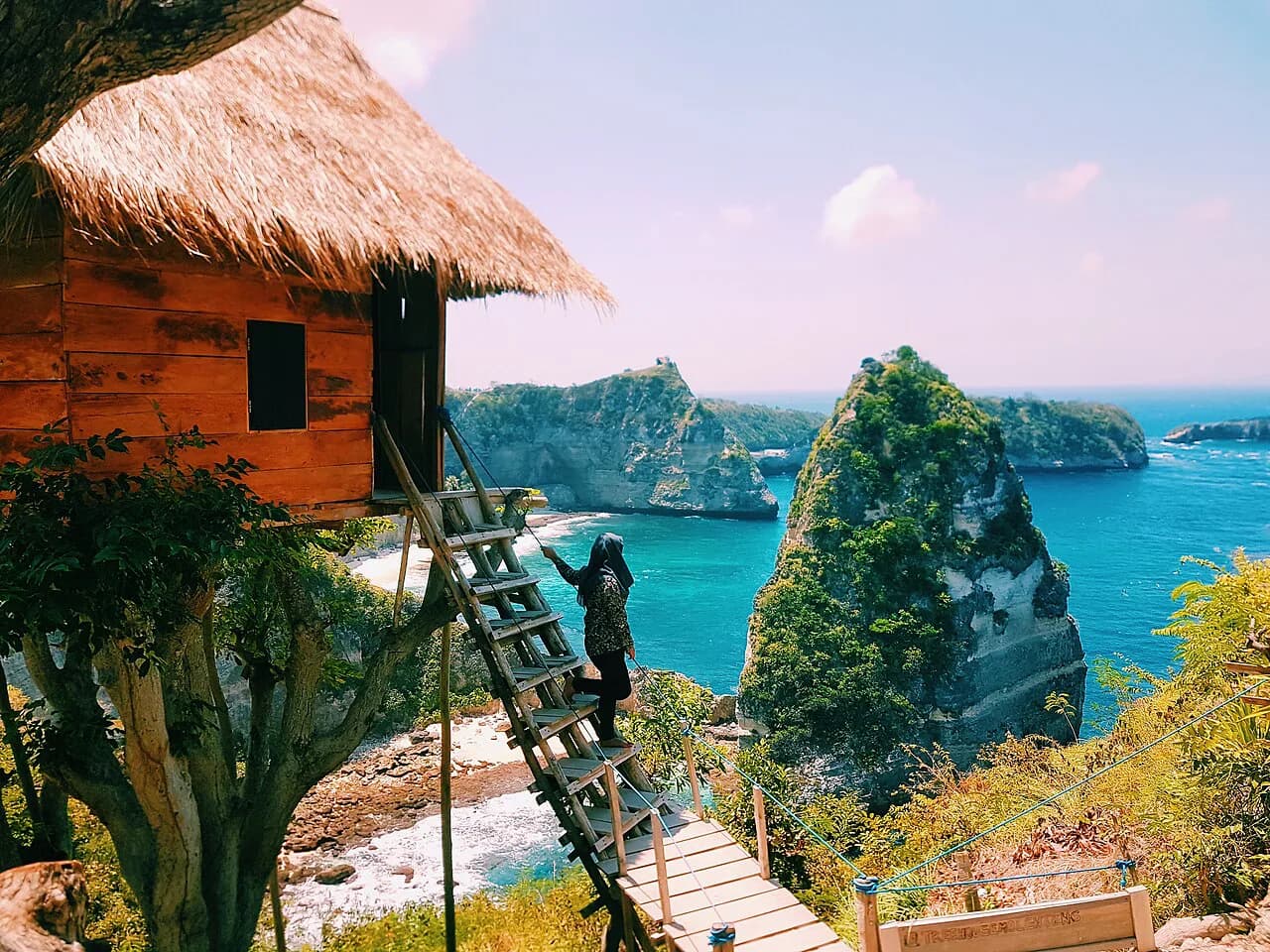
Atuh pairs naturally with two other east-side sights. Diamond Beach, Nusa Penida's stepped-cliff neighbor, is a short ride away and is often visited on the same circuit, and the Rumah Pohon Tree House viewpoint sits nearby. One traveler's guide bundles all three into a single east-side tour, which is a sensible structure if you are not self-driving.
The western viewpoints are a separate day. Kelingking Beach, Nusa Penida's famous headland in Bunga Mekar, sits on the opposite side of the island and deserves its own half-day rather than a rushed add-on after Atuh.
Beaches on the north and west coasts round out a longer stay. Crystal Bay, Nusa Penida's sunset beach near the harbor side, works as an evening stop on another day, while the cliff formations at Broken Beach and Angel's Billabong cluster together on the west coast for a second outing.
Is Atuh Beach worth the ride east?
Yes, if you treat it as an east-side half-day rather than a quick swim stop. The clifftop view, the stairway descent, and the rock arch at eye level set Atuh apart from Nusa Penida's western headline sights, and the effort of getting there keeps the sand quieter than the island's busier beaches.
Go early, carry small rupiah notes for the booth and cafes, plan for the climb back up, and make your own call on swimming once you see the water. Pair it with Diamond Beach and Rumah Pohon if you have a driver or tour booked, and confirm fees and access locally before you set out.
Explore more Nusa Penida guides
Frequently Asked Questions
Where is Nusa Penida island?
Nusa Penida is the largest of the three Nusa islands, sitting off the southeastern coast of Bali in Klungkung Regency. Fast boats connect it to Bali, and Atuh Beach lies on the island's far southeastern tip in Pejukutan village, roughly 28 kilometers by road from Toya Pakeh Harbor.
Is Nusa Penida really worth it?
For travelers who want dramatic coastal scenery, yes, but it rewards planning. The island's highlights are spread across opposite coasts, so a one-day dash covers little. If Atuh Beach is your priority, base yourself for at least a night and give the east side its own half-day rather than squeezing it between western viewpoints.
Sources
- Atuh Beach Nusa Penida Island: The Ultimate Guide
- Pantai Atuh - Love Bali
- Take a look at this reel, Atuh Beach - save this spot for your future trip to Bali! Atuh Beach is one of the beautiful hidden beaches in Bali. Located on Nusa Penida island, you can see the enchanting beauty of Atuh Beach from the rugged cliffs. The best time to visit is to see this clean white sand
- Atuh Beach | Entrance Fee, Opening Hours & More
- Pantai Atuh Beach in Bali - Hidden Beach in Nusa Penida - Go Guides