
Taman Hutan Raya Ir. H. Djuanda: What to See at Tahura Bandung

Taman Hutan Raya Ir. H. Djuanda is a 590-hectare conservation forest on Gunung Pulosari, stretching from Dago Pakar in the north of Bandung up toward Maribaya, and it needs roughly three to five hours of your day. Treat it as a dispersed forest with several separate stops rather than a single walled sight, and you will plan it far better. This guide covers where the entrances sit, how the caves and waterfalls group together, what the gate and inner sites cost, and what a realistic half day looks like.
What Taman Hutan Raya Ir. H. Djuanda Actually Is
Locals shorten the name to Tahura Djuanda or THR Juanda, and the area is managed as a conservation forest by the West Java provincial forestry department. The land began as a much smaller protected forest under the Dutch colonial administration in 1912 and has since grown into a landscape of roughly 2,500 plant types across 40 families and 112 species. It is named for Ir. H. Djuanda, the Indonesian prime minister associated with the 1957 declaration that shaped the country's archipelagic boundaries.
The park sits in Cimenyan, Kabupaten Bandung, on the hills that rise immediately behind the city's northern districts, and it runs from the Dago Pakar side across to the Maribaya area near Lembang. Because it is a long ridge rather than a compact square, the gate you choose determines which stop you reach first. That geography is the single most useful thing to understand before you set out.
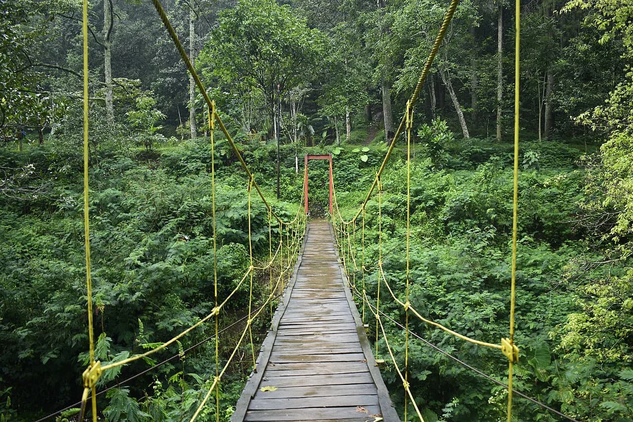
This is forest park territory, not a jungle expedition: much of the road surface inside is paved or in good condition, and visitors typically come to walk, cycle, jog, picnic, or photograph rather than to trek. If you were expecting a wild, unmarked trail network, reset your expectations toward a shaded route with signposted stops.
Where It Sits and How to Get There
The main day-to-day entrance is off Jalan Ir. H. Juanda in Ciburial, at the top of the Dago Pakar climb, which puts you closest to the caves. Ride-hailing apps such as Grab and Gojek work here, but the last stretch is a steep uphill road, so agree on the drop-off point at the gate rather than on Jalan Ir. H. Juanda generally. A private driver for the day is the least stressful option if you also want to continue to Lembang afterward.
Approaching from the Maribaya side near Lembang gives you a different first stop and suits anyone combining the park with the Lembang run rather than with central Bandung. Whichever way you come, confirm the correct gate with your driver before setting off, because the park's long shape means entering at the wrong end adds real distance inside.
There are no published travel times from central Bandung that hold reliably given the city's northern traffic, so build in slack rather than trusting an app estimate at rush hour. If you want the wider context of what else is worth your time in the city, our Bandung Attractions: 13 Visitor Guides covers the sights in other districts.
Getting Around Inside: Walking Versus Driving
Distances between stops are the make-or-break detail here. Gua Belanda lies about 500 meters from the main entrance, and Gua Jepang sits roughly 300 meters beyond that, so those two pair naturally as a walk from the Dago Pakar gate. Curug Omas, Curug Dago, and Tebing Keraton, by contrast, sit at different points across the wider forest and are best treated as separate outings or reached with a vehicle.
Some visitors drive between the inner sites, and access to certain spots is by foot or by vehicle depending on where you are heading. If you are on foot, pick one cluster and commit to it rather than trying to tick off the whole forest. That one decision saves more time than any other.
The Main Stops Inside the Park
Gua Belanda is a man-made tunnel from the colonial period rather than a natural cave, which surprises some visitors. Gua Jepang was built by the Japanese military in 1942 as a barracks and shelter, and it has four entrances and two lookout openings. Seeing the two in sequence gives you a compact, concrete lesson in the layers of Bandung's twentieth-century history.
Curug Omas is the park's headline waterfall, dropping around 30 meters into a pool reported to reach about 10 meters deep, while Curug Dago is a smaller fall of roughly 12 meters sitting at about 800 meters above sea level. Both are inside the Tahura area but at different points, so check the route before you commit to walking to either.
Tebing Keraton is the cliff viewpoint at around 1,200 meters above sea level, and despite being inside the Tahura landscape it is usually visited as its own trip rather than as a stop on a cave walk. The park also holds a deer enclosure, the Museum dan Monumen Ir. H. Djuanda, and hot springs among its facilities.
Which Stops Cluster Together
The tightest pairing is Gua Belanda with Gua Jepang, since they are a few hundred meters apart and both are reached from the main entrance side. Almost everything else, including Curug Omas, Curug Dago, Tebing Keraton, and the museum and monument, sits in a different part of the forest and needs either a vehicle or a longer walk.
Treat that split as your planning tool: if you have no car inside the park, do the caves properly and leave the waterfalls for another day. If you have a driver waiting, you can string two or three stops together, but agree on the meeting points in advance because phone signal and pickup clarity vary across a 590-hectare site.
How Long You Really Need
Published guidance puts a recommended visit at three to five hours, which fits a caves-plus-one-waterfall day with time for photos and a picnic. For a half day, pick the Gua Belanda and Gua Jepang cluster and add the museum and monument if you have a vehicle; that is a comfortable, unhurried morning. For a full day, add Curug Omas and consider finishing at Tebing Keraton if the light and the drive allow.
Distances are longer than the map suggests because the forest runs from Dago Pakar to Maribaya, so an ambitious plan to cover everything on foot will collapse by early afternoon. Build the day around one cluster and treat anything beyond it as a bonus rather than an obligation.
Tickets, Hours, and the Foreign-Visitor Rate
Ticket prices differ sharply by nationality: one booking page lists Rp 12,000 for local visitors and Rp 76,000 for foreign visitors aged 4 to 70, with parking charged separately for motorcycles, cars, and buses, and the ticket said to include insurance coverage up to a stated maximum. Treat those figures as the rates reported at the time of writing, not as a guarantee, and confirm at the gate or through the park's own channels before you budget.
Some inner sites charge entry separately on top of the main gate ticket, so a full day of stops can cost more than the headline rate suggests. The park has not published a stable breakdown of which stops charge and how much, so ask at the entrance which of the day's stops carry an extra ticket.
Opening hours are reported inconsistently, with one listing giving 8:00 to 16:00 and another giving 8:00 to 18:00 daily. Because of that conflict, check the current hours with the park's own social media account, which is the most direct channel for day-to-day changes.
Facilities on the Ground
Despite being a forest, the park has the practical basics: toilets, a prayer area, parking, a children's play area, a camping zone, and hot springs. Paths are in good condition with paved stretches, which means ordinary shoes are fine for the main routes near the gate.
Food is the part that trips people up. The cafes that once operated inside the forest were moved out because they were judged to interfere with the area's water-absorption function, so plan on bringing your own food and water or eating before or after your visit rather than partway through.
Nearby Options on the Same Dago Pakar–Lembang Run
Tahura Djuanda sits on the natural route between Dago Pakar and Lembang, so it pairs easily with that corridor rather than with the city's colonial core. If you are building a Bandung itinerary around architectural landmarks, keep the Gedung Sate, Bandung on a separate downtown day and give the forest its own half day.
For contrast on another day, Braga street concentrates heritage buildings, cafes, and evening activity in one walkable downtown strip. It is a very different experience from a forest park, which is exactly why the two work well in one trip.
Half Day at the Caves or a Full Day in the Forest?
Choose the half day if you are without a car inside the park: focus on Gua Belanda and Gua Jepang from the Jalan Ir. H. Juanda entrance, add the Ir. H. Djuanda museum and monument, and bring your own food. Choose the full day only if you have a driver or are willing to cover real distances, because the waterfalls and Tebing Keraton are spread across the 590-hectare landscape.
Before you go, settle two things: which gate you are entering, and the current hours and ticket rates for your nationality. The park has not published a stable, single set of figures across sources, so a quick check on its Instagram account or a question at the gate is the reliable move.
Explore more Bandung guides
Frequently Asked Questions
Is Taman Hutan Raya Ir. H. Djuanda worth visiting?
Yes, if you want a shaded forest day with colonial and wartime history rather than a checklist of sights. Gua Belanda and Gua Jepang sit close to the main entrance off Jalan Ir. H. Juanda, so the caves alone justify a morning. The waterfalls and Tebing Keraton are spread across the wider forest and need a car or a fuller day to reach.
Is Tahura Djuanda the same as Tebing Keraton?
No. Tebing Keraton is the cliff viewpoint at around 1,200 meters above sea level that sits within the Tahura Djuanda landscape, but it is a specific stop rather than another name for the park. Most visitors treat it as its own outing rather than part of a walk to the caves.
Do you need a car to get around Tahura Djuanda?
Not for the caves, which lie within a few hundred meters of each other and of the main gate. You do need a vehicle, or a willingness to walk a long way, to link the caves with Curug Omas, Curug Dago, and Tebing Keraton. If you are on foot, pick one cluster and plan around it.